Features
What Routes does
A route builder, turn-by-turn navigation, ride recording and a community for riders, on one map. It runs in the browser today, with iPhone and Android apps on the way.
Plan
Twisty route builder FREE
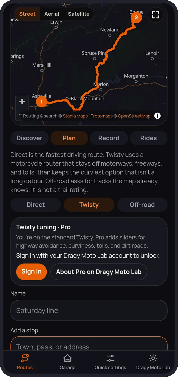
Add a start, stops and a finish by searching for a town, pass or address, or tap the map. Then pick how to get there:
- Direct: the fastest driving route.
- Twisty: a motorcycle router that stays off motorways, freeways and tolls, then keeps the curviest option that isn’t a long detour.
- Off-road: follows tracks the map already knows. It’s not a trail rating.
Distance, time and the weather along the way show before you go. Save plans, export GPX, and with Pro tune Twisty with sliders for curviness, highway and toll avoidance and dirt tolerance.
Ride
Turn-by-turn navigation FREE
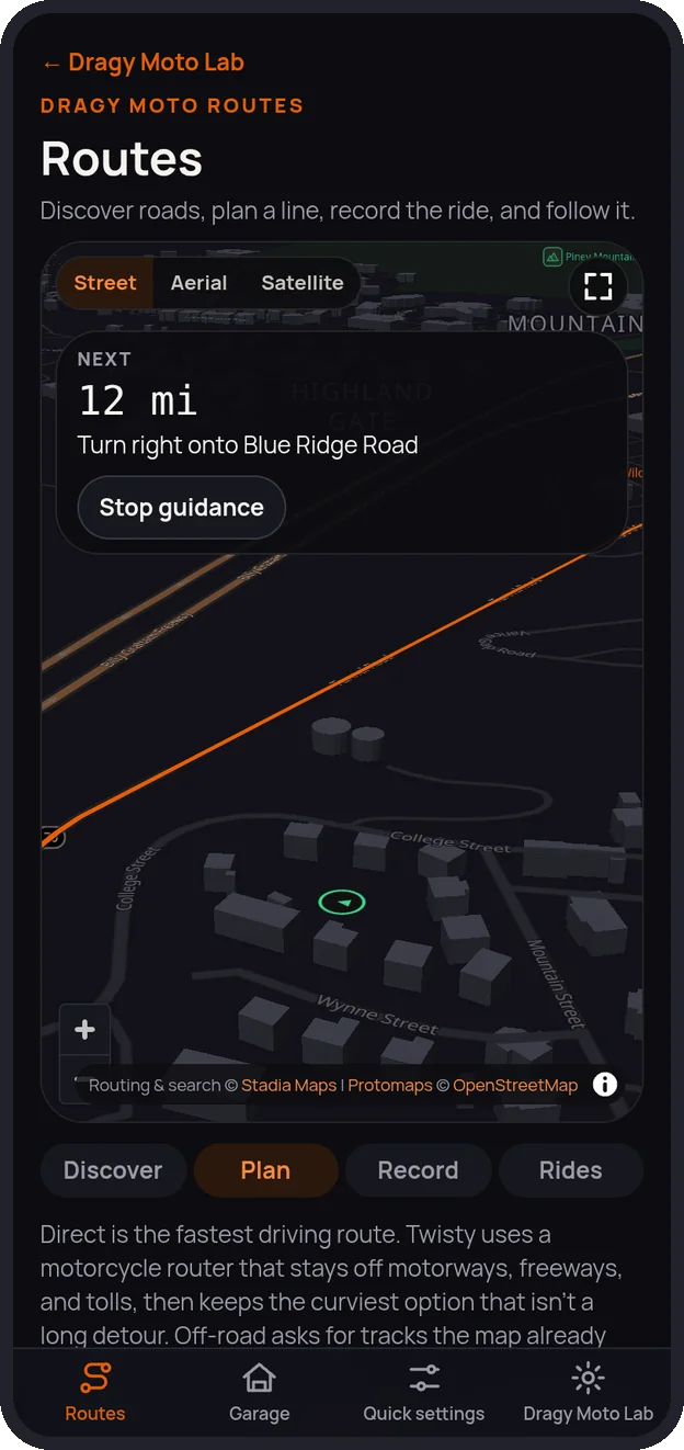
- Phone-GPS style: a close zoom and a 3D street-level view with buildings, and the map turns with your heading.
- Spoken cues for each turn, and the banner shows the next turn and distance.
- Pan away to look around, then tap Recenter to snap back to you.
- Swipe the turn banner left and right to preview every step to the destination and back. The map follows the step you’re viewing, and your current turn keeps updating. SOON
Map
Street, Aerial and Satellite FREE
A dark street map made for riding, plus Aerial (imagery with our roads and labels) and Satellite (imagery only). Switch on the map, and use the full-screen button on the web and in the apps.
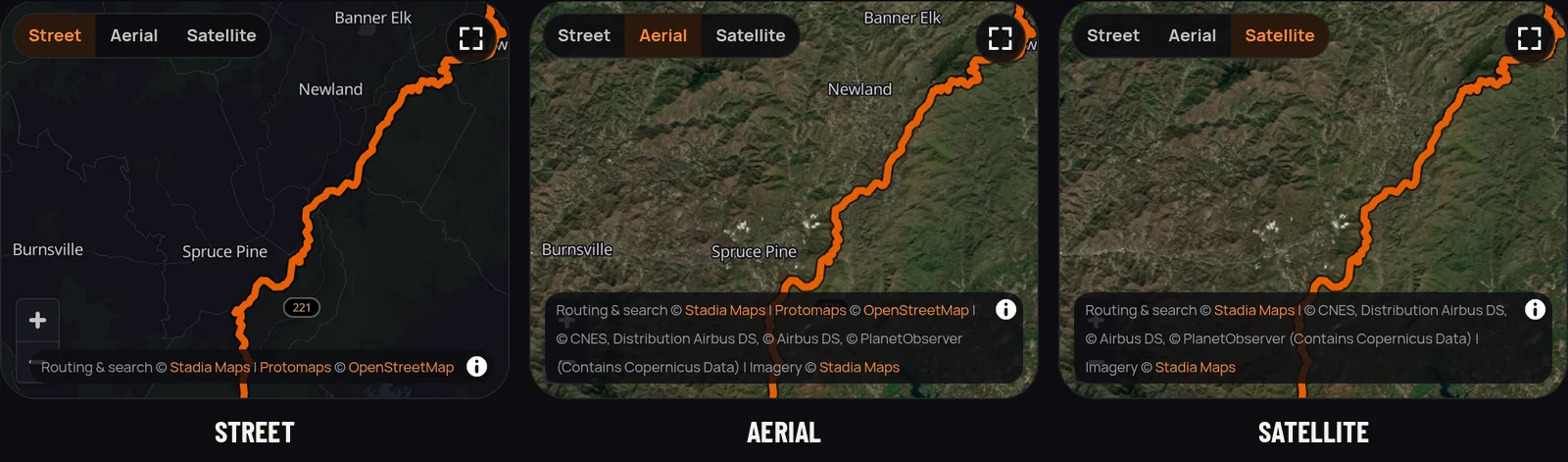
Satellite imagery comes from Stadia Maps, with US Geological Survey imagery as a fallback in the US.
Record
Ride recording and the ride dashboard FREE
Record a ride with your phone’s GPS. If the phone or tab closes, the ride is saved every few seconds and picks up where it left off.
- Lean angle, acceleration and braking, recorded from a connected GPS device, your phone’s motion sensors, or worked out from GPS. SOON
- Live dashboard: a bike icon that leans with you, a lean arc with your max each side, a g-meter, an accel/brake bar, speed and maxes. Works in full screen and in navigation. SOON
- After the ride: charts and the track colored by lean or braking. SOON
- Export GPX, or import one as a ride. Pro backs rides up to your account.
Map
Map legend: gas, food, tolls and more FREE SOON
Turn categories on in the legend: gas stations, EV charging, food, coffee, shopping centers, lodging, parking, motorcycle shops, hospitals, police, viewpoints and tolls. Your choices are remembered. Tap a place to add it as a stop or navigate to it. Tolls on your route come from the router.
Discover
Discover roads where you ride FREE
A shelf of great roads to start from, with tight, scenic and off-road filters.
- Choose Use my location or Pick a location: a city, county, state, ZIP or a riding area like Tail of the Dragon. SOON
- The nearest and best matches come first, the place shows at the top (“Near Canton, MS”), and your recent places are one tap away. SOON
Ride together
Community and group rides FREE SOON
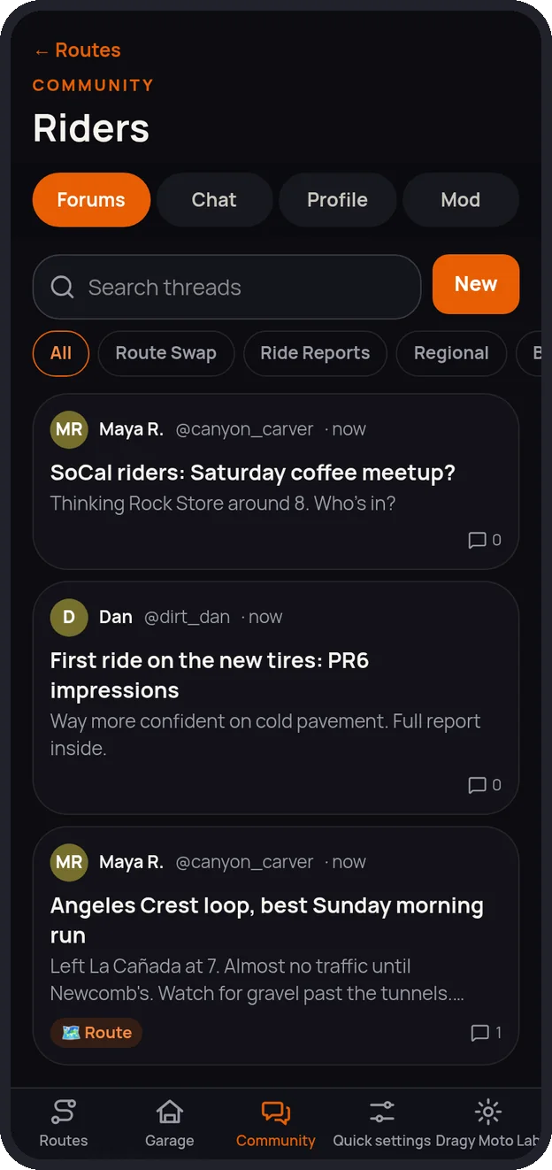
- Forums to compare and share routes, ride reports and regional threads.
- Group chats you create, private group chats for rides, and direct messages.
- Events for rides or anything motorcycle related.
- Live rider map: once you join a group ride, everyone sees each rider as a named dot, updated every few seconds. Tap a dot to center on that rider. Location is shared only during the ride, only if you turn it on. SOON
Community is for riders 18 and older and is moderated. Your public profile is off unless you turn it on.
Safety
Crash detection and SOS FREE SOON
- Looks for a hard impact or sudden stop followed by the bike or phone lying still on its side.
- Then a loud alarm and a 30-second countdown with a big I’m OK button.
- If nobody cancels, the SOS goes to everyone in your group ride with your location and a Navigate to rider button, and to your emergency contacts.
- Press and hold the SOS button to send one yourself.
- Choose who to call or text, your message, medical info, the countdown length and group alerts.
Crash detection can miss a crash or go off when you haven’t crashed. It doesn’t replace calling 911. Automatic texts to your contacts aren’t switched on yet.
Dragy Moto Lab
Send rides to Dragy Moto Lab PRO SOON
One tap on a recorded ride sends it to your Lab account and opens it in the Lab: the track on a map, lean and g-force charts, the summary, and speed runs like 0–60 and 60–130 found and timed automatically, like Lab timer runs. Not signed in, or not Pro? Save the ride file and import it into the Lab yourself.
Account
One account with Dragy Moto Lab FREE
- Sign in with your Dragy Moto Lab account (optional). Your garage syncs between Routes and the Lab.
- Lab Pro unlocks Routes Pro.
- The Dragy Moto Lab button in the app opens the Lab app if it’s installed, or the Lab website.
- Delete your account in the app any time.
Made for your phone
Large touch targets, a dark theme for riding at night, safe-area support for notched phones, and full screen. Install it from the browser menu (Add to Home Screen).
Set your route before you ride and keep your eyes on the road. Route suggestions are only suggestions: check closures, conditions and private land yourself, and follow the law.